The story of Mary Magdalene reflects a future day for all of us individually. Mary had found herself in Jesus Christ. He brought out the best in her and showed her her own divine importance. There was no one who had done more for her in her life than Jesus. Suddenly, He was seemingly ripped out of her life only days after His triumphant entry into Jerusalem.
Now she was left alone and her distraught further deepened by the disappearance of His body. She surely must have felt that all had gone wrong and that even the small comfort of mourning had been stolen by someone taking His body away. So depressed and hopeless, she was unable to anticipate the miracle she was about to experience. In her story, when she finally recognizes Jesus’s resurrected face, we ourselves see not only Jesus Christ, but also the faces of those smaller saviors who have passed from our lives.
Because Mary saw Jesus again, we will also be able to see those who have left us. Those parents, spouses, friends, and others who spent their lives with us and built us into the people we are will be resurrected and all will be united. Christ brought all of us with Him back to life. This is the most important doctrine. Because Christ lives, so do we all.
Music: Violin Version of Piano Guys’ O Come O Come Emmanuel
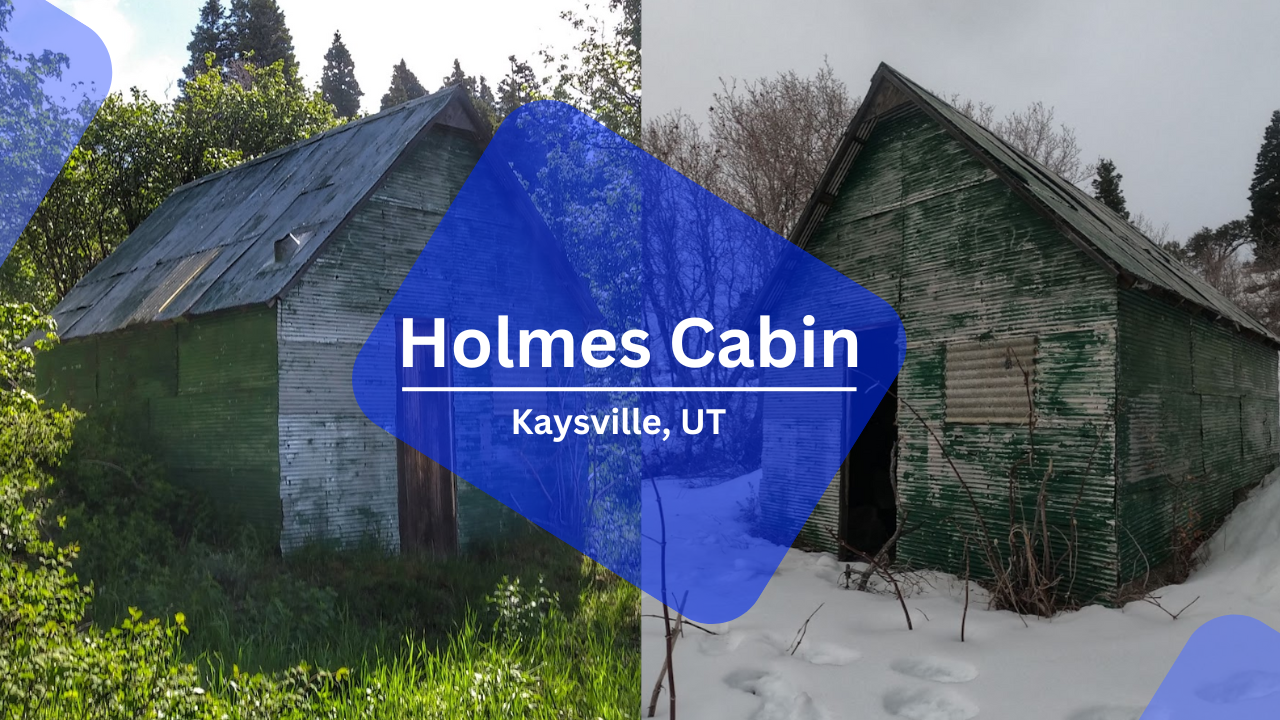
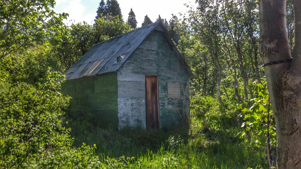
Holme’s Cabin is a lesser known cabin located about halfway up the mountains East of Kaysville. It is accessible starting from the Kaysville East Wilderness Park trailhead and involves climbing 2800 feet of elevation in about three miles making it a very steep hike or run. It is on the ridge South of Adam’s Canyon and North of its namesake Holmes Creek.
Starting the Journey
The closest place to park is at East Mountain Wilderness Park. From there, you can travel up the dirt road until you get to the turn off for the Bonneville Shoreline Trail. Keep north on the trail, going past the bridge until you get to this point pictured below and also marked here on google maps.
At the blue marker pointing left for BST, you will want to take a right to start going up the mountain. The next section of trail is crossed by a lot of other smaller foot paths through the sage brush. A good rule of thumb for keeping on the right path is that you should always be heading up the mountain. There are no downhills and the path does not cut across the mountain to make the way less steep.
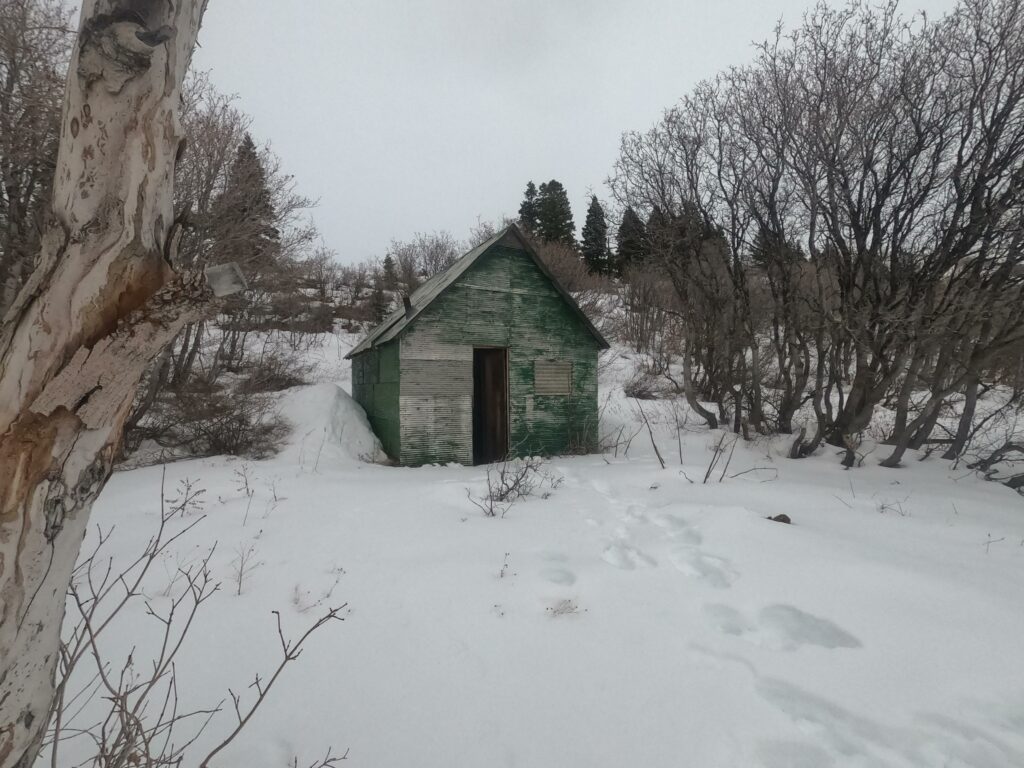
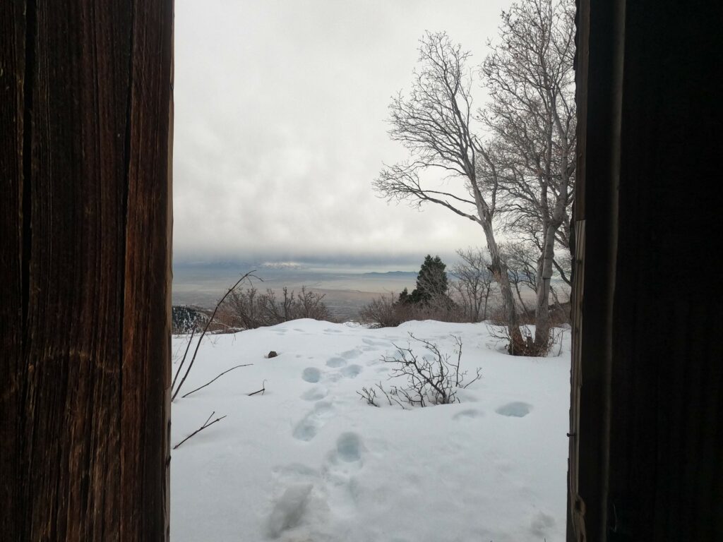
The trek to the cabin is not a lot of mileage, but the steep trail conditions can make it take many hours. If done in the winter, expect considerable snow.
In snowy conditions it is particularly difficult to find the trail since it is not typically well traveled. In this last winter I had to consult maps on my watch very frequently to keep on the right track towards the end of the run.
The Cabin
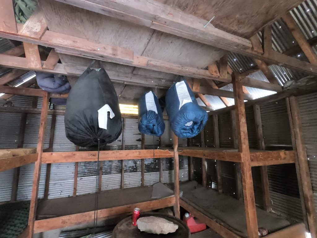
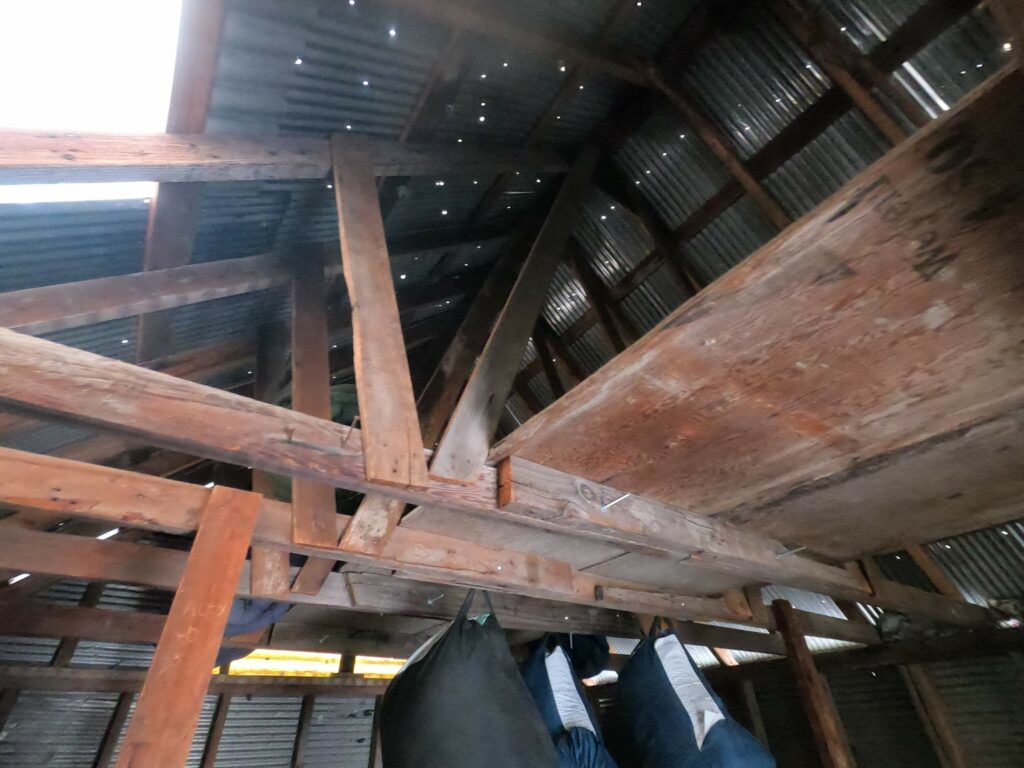
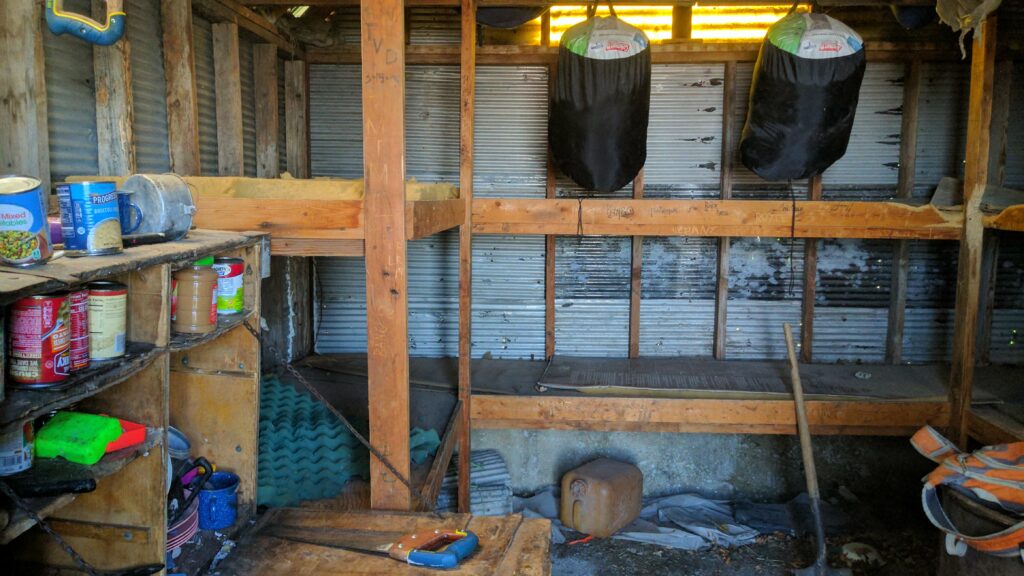
Of the Davis County cabins, Holmes cabin is a sturdy contender. It is not as robust as its neighbor Adam’s cabin, but it is in far better condition than Fernwood cabin which at this point I am guessing has collapsed. Holmes cabin has quite a lot of provisions, though don’t expect free food. The cans of food that were there earlier this year expired in 2014. There are enough supplies to start a fire though if needed. Additionally, there are also sleeping bags hanging from the rafters.
Some Sleeping Bags
Years ago there was a blog post about some winter backpackers who stayed the night at Holmes cabin. That blog seems to have since gone offline, but to my remembrance they appeared to have had an enjoyable time staying the night. It is important to note, that like the other cabins, you do have to worry about rodent droppings. Squirrels and mice are frequent inhabitants of these cabins and they leave stuff everywhere. The first time I visited Holmes cabin, I opened the door and squirrels went scurrying out from everywhere much to the delight of my dog.
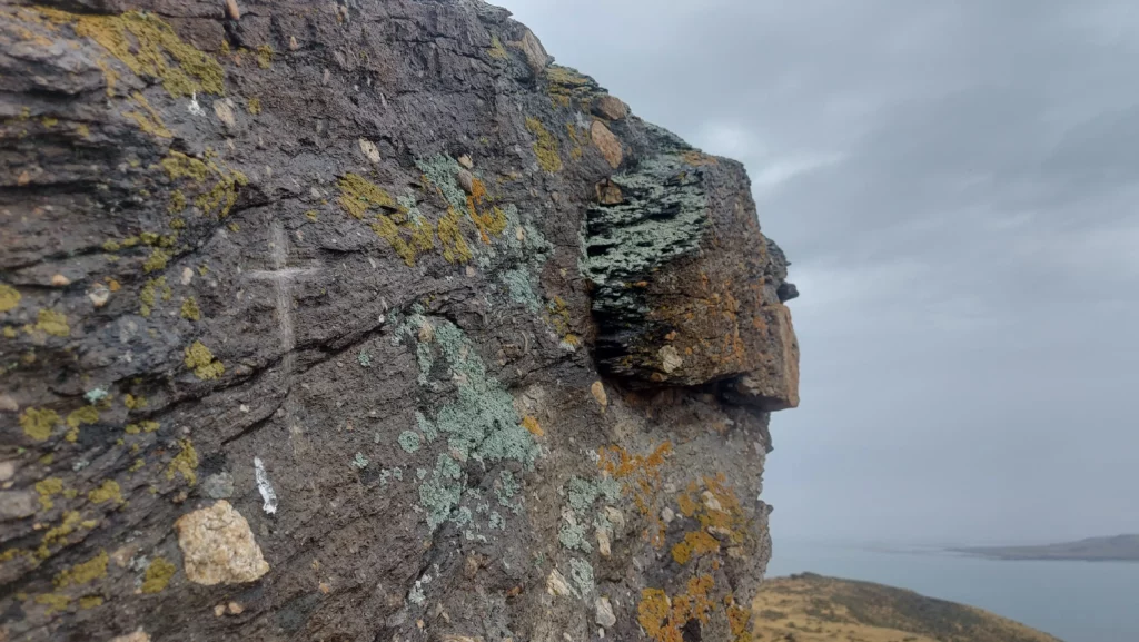
Despite being a relatively sparse wasteland, Fremont Island has a decently interesting history. Located 6 miles northwest from the far more popular Antelope Island, Fremont Island is a standing record of the island’s few visitors through the centuries. Hundreds of years ago, Native Americans used the island for different plants and resources. They left behind a few artifacts including some petroglyphs. In the preceding two centuries, white explorers and settlers have added their mark on the island. Explorers John C. Fremont and Kit Carson visited the island in 1843 and Kit Carson etched a cross into a rock that is still visible today.
Kit Carson’s Cross on Castle Rock
After the pioneers arrived in the Utah area, the island was used for various purposes including mining, sheep herding, and once Brigham Young even exiled a grave robber to the island for his crimes. The only known long term residents of the island have been the Wenner family who owned the island from 1886 to 1960. Uriah Wenner, a Salt Lake County judge, bought the island from the Union Pacific in hopes that the salty air would help him handle his tuberculosis. (History of the Wenner Family)
Today the island is owned by the State of Utah and is publicly accessible by foot or biking. Motorized vehicles are not allowed and camping is also prohibited in order to preserve the island.
Getting to the island
I made my journey to the island mid-August 2023. That day, there were heavy rainstorms sweeping across the lake. As I drove across the causeway, rain pounded my vehicle and I started to wonder if I would be able to make the run. Visibility was low and I could not see the island, just a wall of white to the north. I parked at the U.S. Army Ranger and Air Force Memorial and ran two miles back on the causeway.
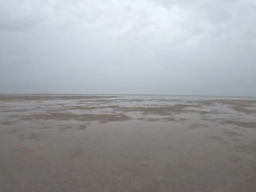
I hopped off the causeway and started running on the sandbar which was starting to fill up with water. Every step I sank into the increasingly muddy mess. The mud suctioned around my feet making it good work to pull them back up with every pace. The smell of the Great Salt Lake resembles rotten eggs and the mud seemed then to be the very essence of it mixed with slimy somethings and decaying organic matter. Large swaths of gnats huddled on the sand, grounded by the weather.
Had I not had a GPS device I would not have been able to discern the correct way to go because of the heavy rain. The island was definitely farther West than I had been thinking, but checking in every now and then with the GPS allowed me to keep heading the correct way. Usually, the island is easily visible so this is not a typical problem when making the trek.
A view of my surroundings
The obscured and uniform view in all directions was actually kind of a pleasant environment to run in. After an hour of steady plodding through the mud, the intensity of the rain started to abate and visibility started to increase.
Because of the previous lack of visibility and rising water, I did end up running slightly off where the sandbar is supposed to be and into deeper waters for a while. On a sunny day this would be easily avoidable. The last mile to the island was me splashing through the water and trying not to fall. Though at this point, I could not get any wetter.
Trudging through the last part
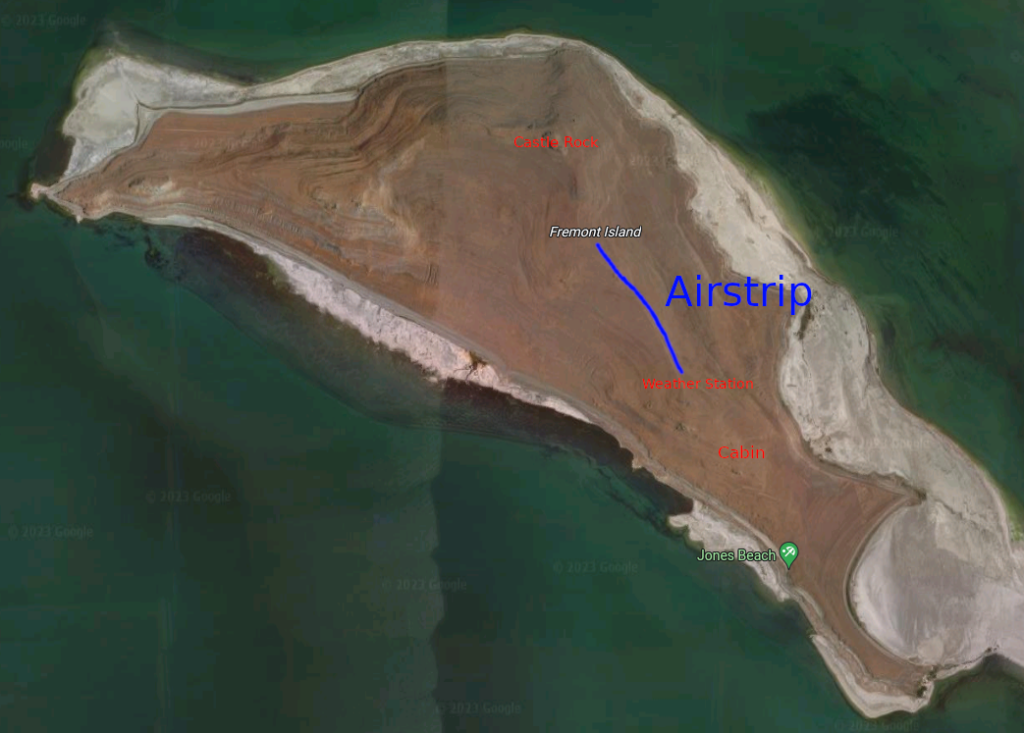
I entered the island from the southeastern side where I was greeted by a trail camera monitoring the island’s visitors. There is a dirt road running along the edge that leads up to an old cabin structure built by Justin Barrow, a previous owner of the island who tried to make a private hunting business by bringing in exotic animals in the 2000’s.
Justin Barrow Cabin
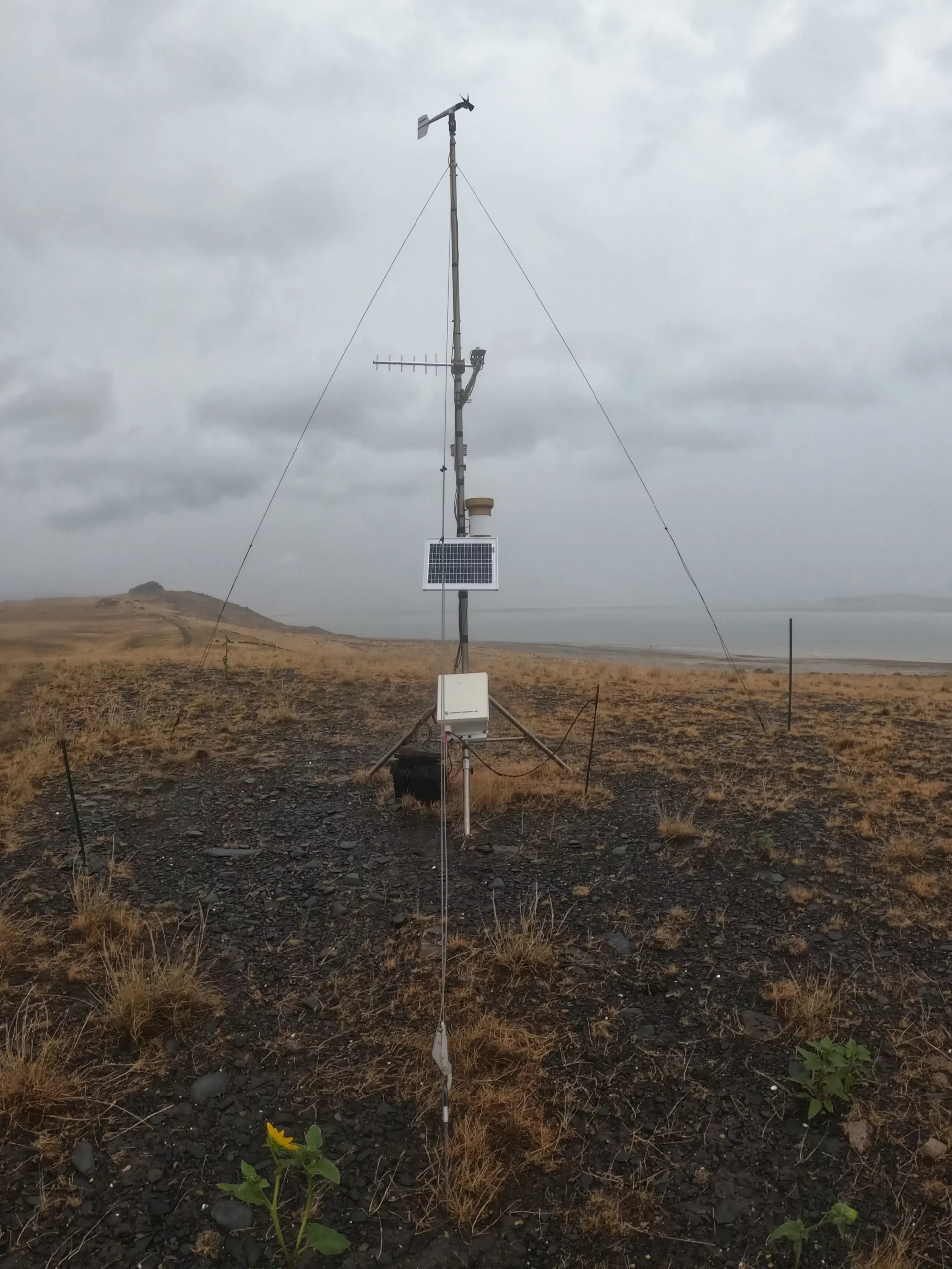
From the cabin, I ran up the road north to the top of David E. Miller hill where the University of Utah has a weather station. The next stretch from there is the island’s airstrip along the central ridge of the island.
Basic Map of the IslandU of U Weather Station, David E Miller HillWindsock at the Airstrip
All in all, the total running distance from Antelope Island to Castle Rock was about 12 miles. The final climb up to Castle Rock is very steep and may involve some clambering on all fours depending on the side of the hill. I approached from the east side and left on the north side. In my estimation there is not a side of the hill that is any easier than the others to climb. All are pretty steep.
Castle Rock stands out well and Kit Carson’s cross is easy to locate on the east side of the rock. This marks the highest point of Fremont Island and provides a view of the surrounding lake and mountains.
During my stay on the island, the rain had stopped and the water levels on the sandbar had fallen. On my return across the sandbar, I had pretty good weather for about a mile. The bugs took advantage of this for a little bit and were quite a nuisance, apparently attracted to my head. Along the way back I noticed there seems to be these wooden posts driven in the ground at various intervals marking the way to the island. If there is any bad weather though, they are pretty much invisible.
Eventually the rain returned, although much lighter, but accompanied by very fierce winds. The last few miles getting off of the sand were very muddy and the unstable ground was starting to take a toll on my legs. All in all, the trip was a total 24 miles and well worth it. I will definitely return to the island, but probably in better weather. There is still more things to find and areas to explore.